Although I haven't blogged recently I have continued to train with hikes around Richmond and at Pocahontas State Park where I can cover 15+ miles without having to cover the same ground twice.
In the meantime spring has arrived with flowers in the forest, leaves and flowers on the trees and birds and animals very active. Here are a few of the sights from recent trips.


The level of the river has gone down and left piles of debris which was washed down with the high water levels of 2-3 weeks ago on the rocks.


The power of the water is amazing.
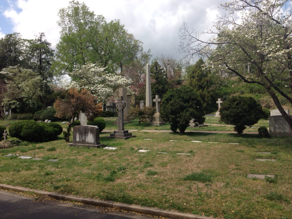
I have previously written about Hollywood Cemetery and this makes an interesting part of a local walk in Richmond. But the James River itself is also fascinating. Soon after the first English colony was started in 1607 near the mouth of the River into the Chesapeake Bay, a settlement, which later developed into what is Richmond today, was established at the foot of the rapids on the river. The site for Richmond was chosen as it was the furthest navigable point on the river and is tidal almost the whole way. At this point there begin 7 miles of rapids and Richmond has grown up over the past 400 years along the rapids on both sides of the river. The falls are caused by the river cutting through a band of granite rock that stretches 1000 miles from New Jersey to Georgia.
Because it was not navigable for this stretch, transport of goods to the expanding colony westward from this point was difficult as everything had to be carried around the rapids and then loaded again into boats upstream. In the 1780's the Kanawha Canal was built by African Slaves, Irish laborers and Italian stonemasons. This allowed boats to by-pass the rapids and continue upstream. Locks were necessary and several of them still exist, but are not active or maintained. Two of these locks are close to the starting point for one of my city hikes. A quarry was established nearby to provide materials for the stone walls.


At the same site as the locks, a pumping station was built in 1882 to provide water to the City of Richmond. Thick walls to resist the water pressure and a strong ceiling to support a gantry crane allowed an addition to be made above the pump house. This was used a s a dance hall!
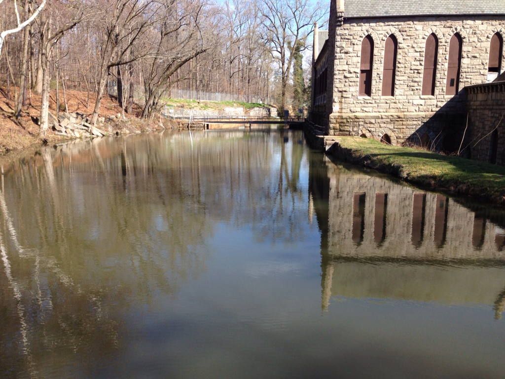
The building looks like a church on the outside.

But the open air upstairs space must have offered marvelous parties. People could arrive by boat on the canal and enjoy an evening with the sound of the river and the falls outside.

Most of the canal still exists but it now dry and overgrown. Here is section further downstream.
It must have had quite a lot of use in its heyday for both passenger and goods traffic. There is a plaque describing a visit to this area by George Washington who stopped here to meet some local dignitaries for lunch but they arrived too late and he had to eat on his own.

The training walks have taken me to many interesting places that I might otherwise not have known about.
I started training in early December and now I feel ready for El Camino. It has been fun experiencing the changing seasons, but reading the reports from Danny and David who started their Camino last weekend has made me anxious to finally get started!
I will leave here on Monday and start the walk on Wednesday 24 April in St Jean Pied de Port France. I hope to be able to blog while on the way and share some pictures, stories and experiences. I am interested to find out how much the experience will be physical and how much spiritual. I found a 9 day "Novena" or 9 day prayer preparation for a pilgrimage on the Internet and I am using it this week as I get ready.
I believe I have all I need - the less the better since I have to carry whatever I take including sleeping bag, rain gear, etc. in a backpack. I hope to be no more than 15 lbs (7kg) but it involves a lot of thought. Perhaps an important part in preparing for a pilgrimage is letting go?
I am so proud of you! Keep up the good blogging.
ReplyDelete